
Why don't we just build a bridge to Hawaii?
It would be so convenient


Now that I’ve lured you into my newsletter for the week, you may think that I’ve gone crazy.
“Surely Geoff knows that this is an impossibility, right? RIGHT?!”
Don’t worry. I do! I mean, the sheer length alone would make the drive impossible for most people.
But despite this seeming like a silly question, I see it pop up time and again. I’ve even been asked it personally a number of times. And a simple Google search will unveil loads of questions across Reddit and Quora asking some variation of whether it’s possible, or why we don’t have one, etc.
The reality is that bridges are incredibly complex. Even over short distances there could be a myriad of reasons for why one hasn’t been built yet, which just so happens to be my video of the week. 😉
But let’s get back to the main question at hand: why don’t we just build a bridge to Hawaii? For lots of reasons!
Its about scale and depth
First, let’s establish the sheer, mind-boggling scale of the problem. The distance from the coast of California to the Hawaiian islands is somewhere around 2,400 miles, or nearly 3,900 kilometers. If you want to get cheeky and build it from the absolutely shortest distance, you can bring that number down to 2,300-ish, but then you’re also not really building it from any major population center so… Regardless, it would easily be the longest bridge the world has ever seen, about 24 times over!
The Danyang–Kunshan Grand Bridge in China, often cited as the world’s longest, is 102 miles long, and it runs mostly over land. The longest continuous bridge over water, the Lake Pontchartrain Causeway, is just under 24 miles. So a bridge to Hawaii would need to be one hundred times longer than the longest water bridge ever constructed. This is so long that the amount of material required would likely exceed the world’s annual production of steel and concrete, probably for several years running.
But distance isn’t even the main problem here. The real barrier is depth.
This probably doesn’t need to be said, but the Pacific Ocean is not shallow. For much of the route, the seabed is over 14,000 feet deep, and in places, it plunges to more than 18,000 feet—that’s well over three miles straight down. Bridge supports, or pylons, would need to be taller than the highest mountains in the continental United States just to reach the surface. To put it plainly, we have never built any structure remotely close to this height, let alone done so underwater in crushing pressures.
Furthermore, this route crosses the “Ring of Fire,” one of the most seismically active zones on Earth. The bridge would need to withstand constant threats from underwater earthquakes, volcanic eruptions, and the tsunamis they generate. It would be an impossible structure built in an impossible location.
So, if the project is this absurd, why do people keep asking about it? The answer lies in how we are taught geography.
The ‘map in the box’ problem
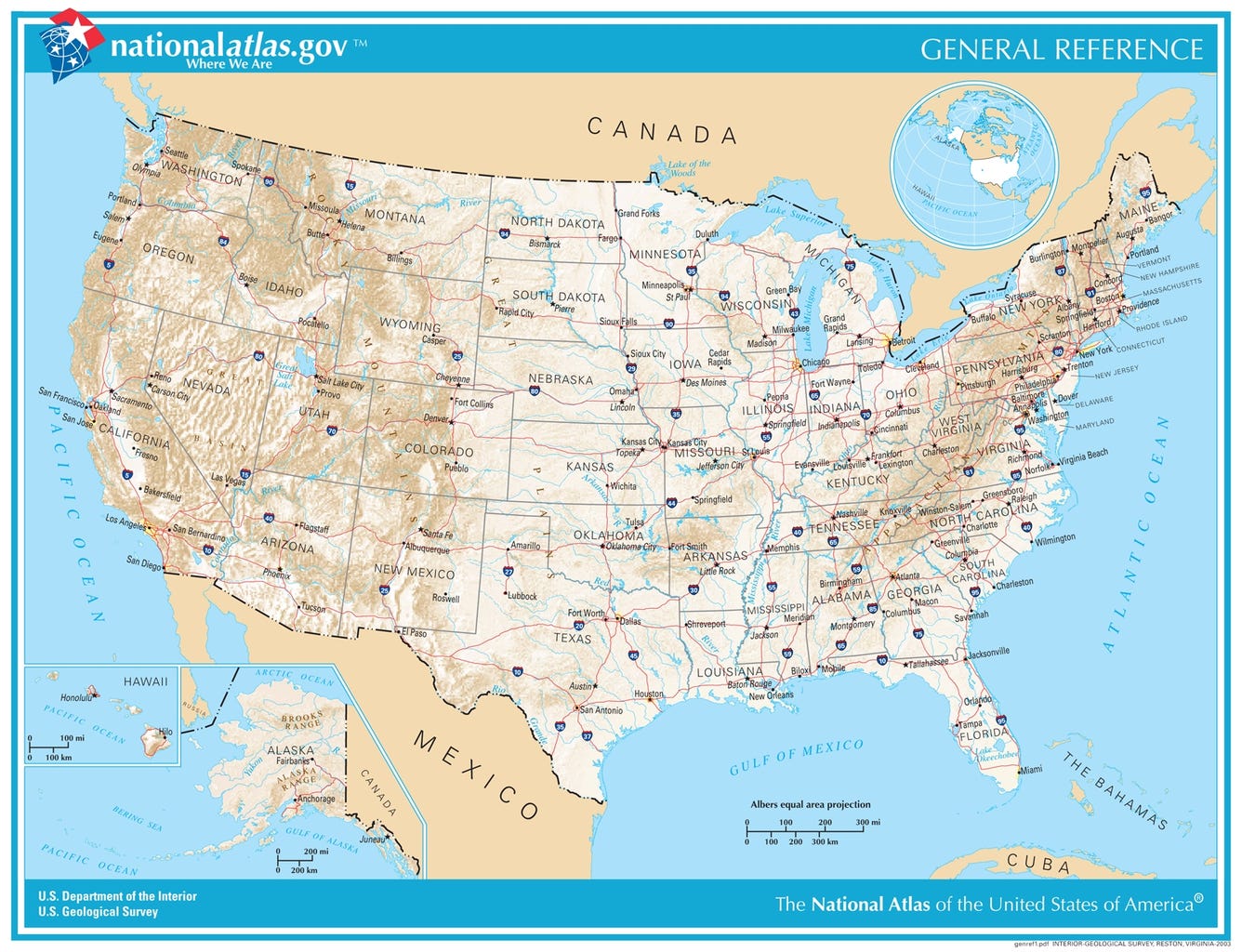
On most maps of the United States, the contiguous 48 states dominate the view. Alaska is shrunk and placed in one corner, and Hawaii is tucked into a convenient box in another. This visual shortcut, designed to fit a country spread out over thousands of miles that are mostly ocean, onto a single page, has has a profound psychological effect on our mental maps. It visually tethers Hawaii to California, making the vast, deep Pacific Ocean feel not that large.
This “flat map” thinking makes us geographically illiterate. We are taught to think of the world in two dimensions (latitude and longitude) but we forget the third dimension: depth and altitude. We understand that the Himalayas are a barrier, but we see the ocean as a flat, blue, featureless expanse.
In reality, the ocean floor is just as varied and dramatic as any continent. It has massive mountain ranges, vast plains, and trenches deeper than Everest is tall. The question “Why not build a bridge to Hawaii?” fundamentally mistakes a political boundary for a geographic one. Just because Hawaii is a U.S. state does not magically move it closer to the mainland. By contrast, it remains one of the most isolated places on the planet.
But is it impossible?
Let’s set aside logistics, economics (which would be in the quadrillions), and basic common sense. From a purely theoretical, “science fiction” standpoint, could a structure ever connect the two?
Probably, but it wouldn’t really be a bridge.
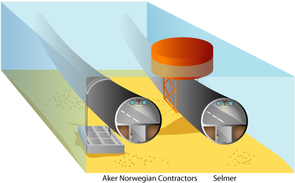
The conventional pylon-supported bridge is an immediate non-starter due to the depth. The only concepts that even begin to address the problem are far more exotic. The most “plausible” idea is a Submerged Floating Tunnel (SFT).
Imagine a massive, buoyant tube, or series of tubes, tethered to the seabed by strong cables, floating perhaps 100 to 200 feet below the surface. This would avoid all weather and wave action, and ships could pass safely overhead. This technology is actively being researched for crossing deep fjords in Norway, which are only a few miles wide.
To scale this up to 2,400 miles, however, presents its own set of nightmarish challenges. How do you anchor anything to a seabed three miles down? How do you construct, connect, and maintain millions of segments of this tube in the open ocean? How do you protect it from a submarine collision or a seismic event that severs its tethers?
And more to that point, where do people refuel, eat, sleep and just generally rest in between California and Hawaii? Figuring out if its scientifically or technologically possible is just one part of the equation. As humans we require a vast network of supportive services in nearly everything we do. This means that there would need to be little towns, or rest stops along the way and who would maintain those? Who would live out in the middle of the ocean just to make sure there was a place for people to stop along the way? It all becomes to incredibly dumb when you really start thinking about it.
So, ultimately, the bridge to Hawaii is just a fantasy. It’s a fun thought experiment, but its primary value isn’t in engineering. It’s in education. The question itself is a valuable tool. It forces us to look past the flat map, appreciate the truly awesome and humbling scale of our planet, and realize that some places are, and should be, wonderfully remote.
I’m sure we could connect a few islands more realistically to Honolulu. Probably still can’t drive from Hilo to Princeville
As a 5th grade teacher I often find myself giggling at some of the ideas on Geography my students say but then I remember that we usually teach from a flat map, and the idea of size is hard to grasp when it’s not to scale. I always have a globe in my room as well, just so when I get asked certain questions like this I can roll it around and show the massive size of certain areas. ( or even the lack of size- Fun concept we just went over was how relatively close Brazil was to Africa which is how the Portuguese found it by accident lol but our map makes it seem farther away!)