One nation?
The U.S. state boundaries never were very good as showing the actual cultures of the country
You know, for as much as the United States likes the word “united” it can often feel anything but. As a lifelong resident of the country and as someone who looks at, studies, and has written extensively on the subject of the human geography of the United States, I can say, without a doubt in my mind, that the U.S. is not united. It’s not divided either, for what it’s worth. These two things aren’t necessarily opposed to each other. Somehow, some way, the U.S. has found itself somewhere in the middle. Americans are American first, most will claim. But they’re not “those Americans” or they don’t like “that kind of American.” It’s an odd dance to be a part of.
I actually wrote about the map above a while back on this Substack. So, if you’re interested that’s the article for you. I’ve also now made a whole video about it for YouTube which you can watch right here:
This article isn’t really about the “American Nations” so much as it is about why we’re so regionally and culturally different from each other. And I have some ideas about that.
State borders aren’t culturally attuned
In this country, everything always boils down to the state. Internally, we Americans LOVE nothing more than to talk about how great our state is, especially in comparison to another state. Californians love to say how much bigger, wealthier, and stronger their state is. While Texans also love to do the same. And if you compare the two directly… oh boy! Watch the fireworks fly. You can apply this to any state and its competing state and roughly get the same results. In this way, the states aren’t all that dissimilar to countries. The people who live in them have a similar sort of national (state) pride. But here’s where things get weird: the states of the United States weren’t culturally created and therefor the internal cracks within each state have really begun to show in 2025.
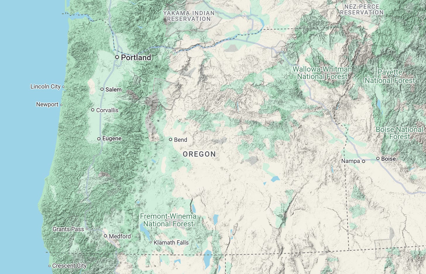
Let’s take my happy-go-lucky state of Oregon as a prime example. Not just because it’s my home, but because I think it provides for one of the starkest internal cultural divides in the country. One that happens to be a pretty stark physical divide as well.
If you know nothing about Oregon, you can probably still look at the map above and derive one thing: the western 1/3rd of the state is different from the eastern 2/3rds. In the west you have a greener, largely mountainous area with plenty of “bigger” cities that Google Maps has deemed suitable for representation at this scale. In the east, however? It looks much drier, flatter, and much more sparsely populated. These things look like this in Google Maps because it’s how Oregon actually looks. Most people don’t realize this but Oregon is mostly an arid/desert state.
This physical divide in Oregon punctuates a cultural divide as well. Eastern Oregon is not progressive. They’re conservative. And this isn’t about politics (though the cultural divide does influence politics as well). It’s just the way of life. It’s more rural, isolated, and generally slower in pace than western Oregon which has the bigger cities, the universities, the cultural amenities, and, most importantly, the vast majority of Oregon’s population.
It’s for this reason that Oregon, despite seeming like its a progressive (culturally and politically) dominated state, is actually much more conservative than many people might think. Because those in eastern Oregon are very conservative. Mostly because they happen to share a lot in common with the state of Idaho, which happens to be one of the most conservative states in the entire United States.
So where am I going with this? Simple: culturally, Oregon probably never would have grown to encompass its current .boundaries had it not been arbitrarily carved up in the mid 1800s. Oregon is a Frankenstein-monster of a state, made up of disparate parts that would never have joined together in a single entity had the cultures grown naturally. They’re simply too different and, back in the 1800s, far to physically divided. And the same can be said for basically every state within the United States.
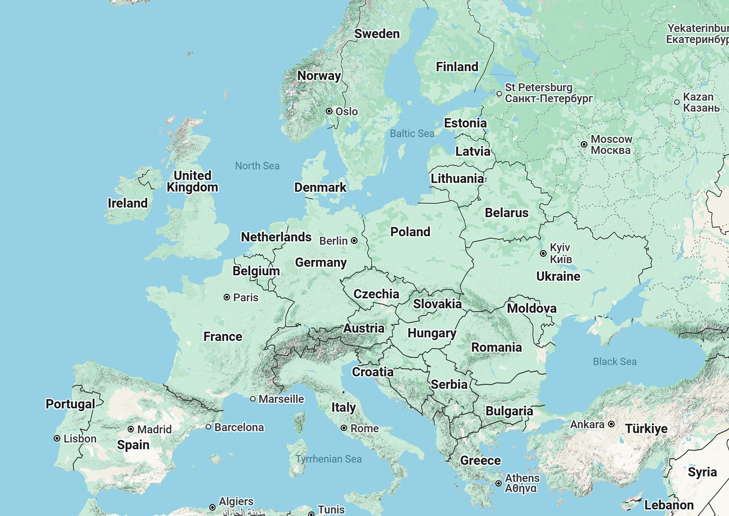
Let’s look to Europe, as an example.
Europe provides one of the best examples of what happens when cultures develop naturally to eventually form culturally homogenous nation-states. This isn’t to say that Europe doesn’t have issues, or that there aren’t internal divisions in each country (there are plenty!) but, at the end of the day, each of these countries is the product of hundreds of years of cultural evolution that brought them to where they are today. They weren’t drawn and carved up on maps over a short period of time like the United States was (or Africa, or South America, or most of the world). Europe can and will change over time, of course, and that will mark another cultural evolution.
But you can see how different it is from the United States. The very lines that make up each country in Europe feel more organic. They feel more natural. And it’s because they are, largely linguistically bound but not always.
Compare Europe to the United States’ internal state borders…
And the differences are stark. The U.S. is filled with straight lines! There’s not a single state in the country (aside from Hawaii) that doesn’t have a mostly straight line that was mostly arbitrarily drawn on a map as Europeans (and then Americans) began colonizing the continent. It doesn’t matter if it was 150, 250, or 350 years ago. These states, which began as colonies, never had the chance to culturally grow because colonial charters and then federal designations carved them up well before culture could decide who was who.
It’s for this reason that the United States and the states themselves are showing the internal divisions so much more than we ever thought they would. In this day and age of lightning-fast communications and very, very fast transportation. It’s become easier to culturally align yourself with others who aren’t part of your state than those who are. It’s why we see eastern Oregon trying to break away from western Oregon to join with Idaho. And, at its heart, it’s the cultural boundaries within the United States showing itself above the state boundaries we’ve all grown up with.
Where does all this internal division lead? No idea! Possibly there will be more attempts at realigning the states such as the Oregon/Idaho efforts I mentioned above. Or the way that California always seems to try to break itself up into multiple new states. I don’t think there’s any need to worry about anything overtly violent spawning out of it. At least not at this stage. But one thing is very clear: culturally, the United States is not divided into 50 cultural states.


To put a Canadian spin on this, I tend to think of us as seven distinct regions: British Columbia (BC), Alberta (AB), Prairies (SK & MB), Ontario, Quebec, Atlantic Canada (NB, NL, NS, PE) and The North (YT, NT, NU). Our Senate is actually divided *somewhat* this way too.
Culturally, the US is more diverse than all 199 countries of the UN.